UN Backs New Map: Africa's True Size Revealed to the World!

UN Backs New Map: Africa's True Size Revealed to the World!
The UN General Assembly endorses the Equal Earth projection, finally showcasing Africa's accurate, massive size. Say goodbye to the distorted Mercator map! #WorldMap #AfricaTrueSize
The United Nations General Assembly has officially endorsed a new world map, the Equal Earth projection, which more accurately represents Africa's vast size. This landmark decision, supported by 164 member states, culminates a dedicated campaign led by African countries and advocacy groups. The resolution, sponsored by Togo and backed by the African Union, was passed with overwhelming support.
Only the United States voted against it, while six other nations, Serbia, Estonia, Georgia, Lithuania, Moldova, and Ukraine, abstained. This move encourages governments and institutions worldwide to transition from the centuries-old Mercator map to the more precise Equal Earth projection.
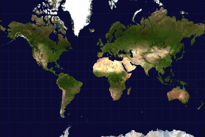
For centuries, the Mercator projection, commonly used since the 16th century, has significantly distorted the sizes of landmasses, particularly making areas farther from the equator appear much larger than they truly are. A striking example of this distortion is how the Mercator map depicts Greenland as appearing roughly the same size as Africa.
However, in reality, the Equal Earth projection reveals that Africa is an astounding 14 times larger than Greenland.
It's important to note that Friday's resolution does not ban the Mercator projection or mandate its replacement. Instead, the U.N. report clarifies that it merely encourages the adoption of the Equal Earth projection.
As Togo's Foreign Minister Robert Dussey stated before the vote,
Maps shape our understanding of the world. They guide education, nourish the imagination, and influence collective perceptions.
Africa No Filter, a key campaigner for the new map's adoption, applauded the resolution, expressing their desire to see accurate maps integrated into schools, textbooks, newsrooms, businesses, and across all digital platforms used globally.
French Foreign Minister Jean-Noël Barrot echoed this sentiment on X, noting, “Changing the map obviously doesn't change the world. But correcting a representation that distorts it is already an act of truth.” The original Mercator map was designed by Flemish cartographer Gerardus Mercator primarily to aid European navigators at sea.
While it served its purpose for maritime navigation, its widespread use in general cartography led to pervasive misconceptions about the true proportions of continents, a distortion the Equal Earth projection now seeks to correct.

Login to comment.
No thots yet. Be the first to share your thoughts!