How 3D City Modeling Relies on High‑Accuracy Mapping Cameras

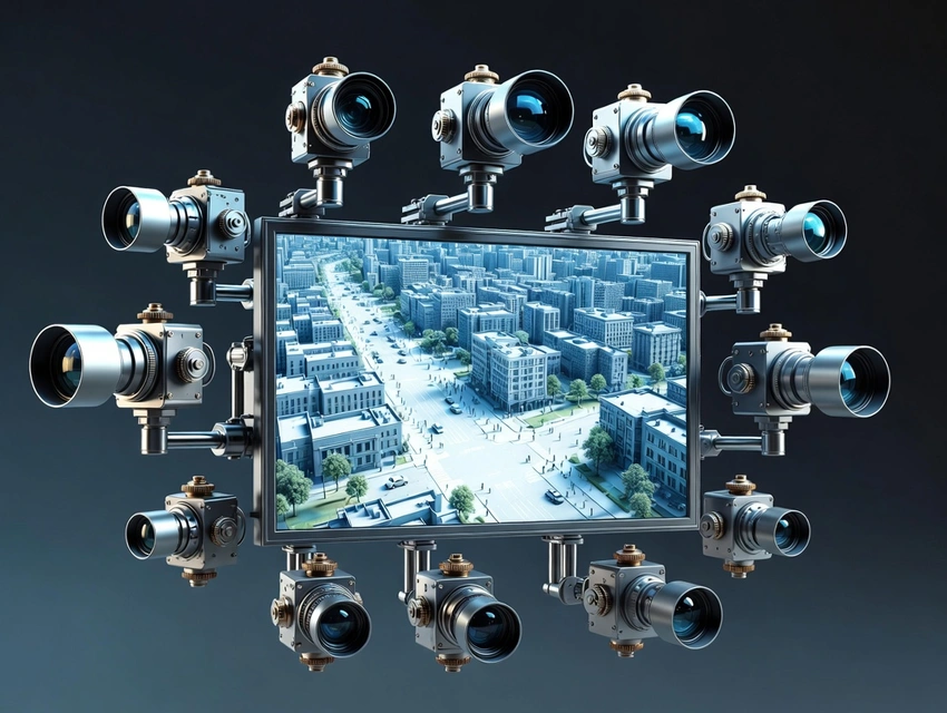
How 3D City Modeling Relies on High‑Accuracy Mapping Cameras
In today’s world, cities are evolving rapidly. Urban planners, architects, engineers, and government agencies increasingly rely on advanced geospatial technologies to visualize, analyze, and plan urban environments. Among the most transformative of these technologies is 3D city modeling, the creation of detailed, three‑dimensional digital representations of urban landscapes. Behind the scenes of this innovation lies a critical piece of hardware: the mapping camera 🔗. By capturing high‑resolution, geometrically accurate aerial data, mapping cameras serve as the foundation upon which realistic and useful 3D city models are built.
At the heart of every successful urban modeling project is an imaging system capable of capturing accurate spatial information across vast areas. A high‑precision camera not only captures detailed photos but also supports the complex photogrammetric processes that transform 2D imagery into 3D city maps. When combined with advanced software and global positioning technology, these cameras allow professionals to build digital models that support planning, simulation, disaster response, and smart‑city development.
This article explores how 3D city modeling depends on high‑accuracy mapping cameras, why such systems are indispensable, and how they enable new levels of insight into the urban environment. Along the way, we will look at real‑world applications, technological frameworks, challenges, and future directions for this rapidly growing field.
What Is 3D City Modeling?
3D city modeling 🔗 refers to the process of creating three‑dimensional digital representations of urban features, including buildings, roads, vegetation, infrastructure, bridges, and even terrain variations. Unlike traditional 2D maps, which show flat representations, 3D models include depth, perspective, and spatial relationships that closely mimic the real world.
At its core, it transforms data from various sources, such as aerial imagery, LiDAR scans, satellite data, and ground surveys, into a structured and geometrically accurate 3D environment. Governments, planners, and private enterprises use these models for a variety of purposes:
- Urban planning and zoning
- Infrastructure design and simulation
- Environmental and flood impact studies
- Navigation and mapping services
- Virtual reality (VR) and augmented reality (AR) applications
- Smart city analytics
This comprehensive visualization enables stakeholders to make data‑driven decisions with better context and foresight.
The Role of Mapping Cameras in 3D City Modeling
To build an accurate 3D model of a city, source data must be precise, detailed, and georeferenced. This is where mapping cameras become essential.
1. Capturing High‑Resolution Imagery
High‑accuracy mapping cameras are designed to capture exceptionally detailed images from airborne platforms such as drones, airplanes, and helicopters. These cameras often feature:
- Large sensors for high image quality
- Precision optics to reduce distortion
- Integration with GNSS (Global Navigation Satellite Systems)
- Inertial Measurement Units (IMUs) to record orientation
This combination ensures that each photograph is not only sharp and detailed but also accurately geo‑tagged, which is essential for photogrammetric reconstruction.
2. Supporting Photogrammetry
Photogrammetry is the science of deriving measurements and 3D coordinates from overlapping 2D images. When a mapping camera captures multiple photographs of the same area from different angles, specialized software can triangulate the position of surface points in space.
Because mapping cameras ensure precise geometric and radiometric calibration, photogrammetric algorithms can produce more accurate point clouds, which serve as the basis for 3D models.
According to the International Society for Photogrammetry and Remote Sensing 🔗 (ISPRS), the quality of imagery, especially geometric calibration and positional accuracy, is the greatest determinant of final 3D model accuracy.
3. Geo‑referencing and Integration with GNSS
Modern mapping cameras typically integrate with GNSS receivers and IMUs, allowing each photo to be tagged with highly accurate position and orientation data. This spatial information enables direct georeferencing, meaning the images are automatically placed within a real‑world coordinate system without extensive ground control points.
This streamlines the workflow and reduces field survey time, making 3D city modeling faster and more cost‑effective.
Key Components of Mapping Camera Systems
To understand how mapping cameras support 3D city modeling, it is helpful to break down their key components:
1. High‑Resolution Sensor
A large and sensitive imaging sensor captures more detail and color information. Higher resolution allows the camera to detect finer architectural details, which translates to richer detail in the 3D model.
2. Precision Optics
Optical systems in mapping cameras are designed to minimize distortion, vignetting, and chromatic aberration. Calibration targets and lens correction profiles ensure that each image has consistent and reliable geometry.
3. GPS/INS Integration
The integration of GPS (for position) and INS (for orientation) ensures that each image can be precisely placed within a global coordinate system, a necessity for creating geo‑referenced models.
4. Advanced Storage and Data Handling
High‑accuracy mapping cameras produce large image files. Efficient onboard storage and fast data transfer capabilities support high‑volume data collection and rapid processing.
5. Compatibility with Photogrammetry and GIS Software
Mapping cameras are designed to work seamlessly with tools like Pix4D, Agisoft Metashape, and ESRI ArcGIS. This ensures that imagery captured from the camera can be quickly transformed into usable 3D models.
How Mapping Cameras Are Used in the 3D City Modeling Workflow
The workflow of 3D city modeling typically involves the following stages, each of which depends on mapping camera data:
1. Planning and Survey Design
Before any imagery is captured, planners design the flight paths, camera angles, and altitude settings needed to ensure sufficient overlap in the images. This planning is essential because photogrammetry requires overlapping photos (usually 60–80% overlap) to triangulate 3D points.
2. Aerial Data Capture
During data collection, the mapping camera captures thousands of images covering the target urban area. The system records GPS and INS data along with the imagery, ensuring each image is accurately placed in space.
3. Pre‑Processing and Calibration
The raw images undergo pre‑processing, which may include color balancing, distortion correction, and verification of positional metadata. This step ensures consistency and quality before photogrammetric processing begins.
4. Photogrammetric Reconstruction
Software such as Pix4D, Agisoft Metashape, or Bentley ContextCapture uses overlapping images to reconstruct a 3D point cloud. These point clouds represent millions of individual 3D points that map the surface of buildings, roads, and terrain.
5. Model Creation and Texturing
Once a dense point cloud is generated, it can be converted into meshes and textured with the original imagery. The result is a realistic 3D model with photorealistic surfaces.
6. Integration into GIS and Urban Planning Tools
The final model is integrated into GIS platforms, urban planning software, or simulation environments where it can be analyzed, shared, and used for decision‑making.
Applications of 3D City Modeling Enabled by Mapping Cameras
The combination of high‑accuracy mapping cameras and 3D city modeling has enabled transformative applications across multiple sectors.
1. Urban Planning and Development
City planners use 3D models to assess land use, visualize zoning scenarios, simulate transportation flows, and forecast population density changes. A 3D model gives planners insight into how proposed developments interact with existing structures and environments.
2. Smart Cities and IoT
Modern smart cities depend on digital twins, virtual replicas of physical infrastructure that are continuously updated with real‑time data. 3D city models form the base layer of these digital twins, allowing sensor data and analytics to be overlaid for precise monitoring and management.
3. Infrastructure Design and Maintenance
Engineers leverage 3D models to plan and design infrastructure such as roads, bridges, utilities, and transit systems. Detailed models help identify spatial conflicts, optimize design parameters, and simulate performance under different conditions.
4. Environmental Impact Studies
3D modeling enhances environmental analysis by providing accurate terrain and surface data. Analysts can simulate flood scenarios, erosion patterns, air flow, and energy consumption models to better understand potential environmental impacts.
5. Navigation, Mapping, and Autonomous Vehicles
Detailed 3D urban maps improve navigation systems and support autonomous vehicle algorithms by providing depth, surface geometry, and lane‑level accuracy. The more accurate the underlying data, the more reliable the navigation.
6. Emergency Response and Disaster Management
During natural disasters or large‑scale emergencies, emergency responders can use up‑to‑date 3D models to understand changes to the city fabric. This helps in planning evacuation routes, locating hazards, and coordinating logistics.
Challenges and Limitations
Despite the many benefits, there are several challenges that 3D city modeling projects must address:
1. Data Volume and Processing Requirements
High‑accuracy mapping cameras produce enormous volumes of data. Processing this imagery into 3D models requires significant computing power and storage. Cloud‑based solutions are increasingly used, but costs can rise with larger datasets.
2. Environmental Conditions
Weather, atmospheric conditions, and lighting can affect image quality. Overcast skies, shadows, and reflective surfaces can introduce noise into photogrammetric workflows.
3. Complex Urban Environments
Highly dense and vertical urban areas pose challenges for photogrammetry due to occlusions, areas that are hidden behind other structures. Combining imagery with LiDAR data can help fill these gaps, but at increased expense.
4. Accuracy and Calibration
Maintaining consistent accuracy requires careful calibration and quality control. Errors in GPS/INS data or lens calibration can propagate through the 3D model, affecting final results.
Future Trends in Mapping Cameras and 3D City Modeling
As technology evolves, the relationship between mapping cameras and 3D city modeling continues to deepen, driven by trends such as:
1. Integration with LiDAR and Multispectral Sensors
While photogrammetry remains powerful, combining data from LiDAR and multispectral sensors improves accuracy in complex environments. Hybrid systems that combine imaging and laser scanning provide richer datasets for modeling.
2. Automation and AI‑Driven Processing
Artificial intelligence (AI) and machine learning algorithms are increasingly used to automate feature extraction, classification, and model refinement. This reduces manual labor and accelerates workflows.
3. Increased Accessibility Through Drones
Consumer and commercial drones equipped with high‑accuracy mapping cameras make urban modeling more accessible to smaller organizations and research institutions. As drone technology matures, costs continue to decrease.
4. Real‑Time 3D Model Updates
With advances in satellite imaging and real‑time sensor networks, it may soon be possible to update city models dynamically. This could be invaluable for disaster response, traffic management, and urban growth monitoring.
5. Virtual and Augmented Reality Applications
3D city models serve as the base for immersive VR and AR experiences that support planning, public engagement, and virtual tourism.
Conclusion
The creation of accurate and detailed 3D city models depends fundamentally on the quality of the data captured at the outset. High‑accuracy mapping cameras provide the essential imagery needed to drive photogrammetric reconstruction, enabling precise and reliable 3D representations of urban environments. As technology continues to evolve, the synergy between advanced cameras, powerful software, and next‑generation sensors will unlock even greater potential for urban innovation.
From smart cities to disaster management, from navigation systems to urban planning, the reliance on precise spatial data has never been greater. By understanding the critical role of mapping cameras, organizations and professionals can better harness the power of 3D city modeling to shape resilient, efficient, and livable cities of the future.
